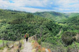
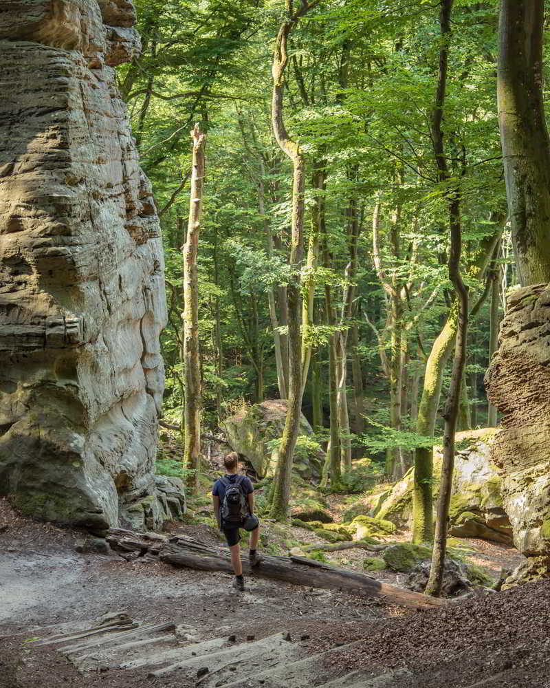
If you love hiking through forests and rock formations, you should visit the Mullerthal region. It lies on the border of Luxembourg and Germany, and is also called “Little Switzerland”. The region is characterized by primeval forest, wild rock formations with different types of moss on it, winding paths next to small streams and gorges where you can walk through. A lovely place to spend a couple of days hiking. In this blog post, we want to share our practical tips for hiking the Mullerthal trail so you can make your trip as memorable as ours.
Table of Contents
Some of the links on this blog are affiliate links. This means if you click on a link and purchase, we receive a small commission at no additional cost to you. The affiliate links concern only products and services we appreciate highly and trust. This means the views and opinions expressed in this post are purely our own. for more information, read our privacy and cookie policy.
How much time do you need to hike the Mullerthal trail?
To answer this question, you first have to decide if you want to do the entire trail or just parts of it. The entire Mullerthal hike entails 112 kilometers in total. These 112 kilometers are divided into three separate circular trails that are 38, 37 and 37 kilometers long. Keep in mind that everybody’s pace is different. Along the way, we saw people running parts of the trail, while others were enjoying the scenery and taking plenty of pictures. It is up to you to decide how many kilometers a day is feasible for you and how much time you can spend in this region. During the summer of 2018, there were a lot of deviations, making the trails longer than normal. Locals or the touristic information offices can give you an update about the trail conditions, so you know what to expect.
How to get to the start of the Mullerthal trail?
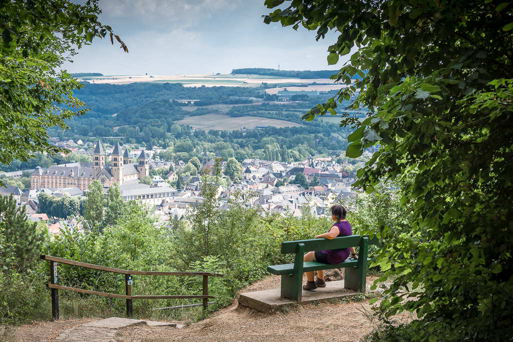
If you are depending on public transport, the easiest reachable town in the Mullerthal region is Echternach. It functions as the main transportation / tourist hub and is also the oldest town in Luxembourg. You can take a bus from the capital of Luxembourg (called Luxembourg-City) that will take you to Echternach (every 30 minutes, direct bus 110 and bus 111). Depending on the place you are staying, you can take an additional bus to your final destination.
Note that this region is also well accessible by car.
Where to stay?
Although there are plenty of busses that can take you to the start of the trail, it might be practical to stay in a village near the start of your preferred trail(s). For example, if you want to combine trails 1 and 2, it can be more practical to stay in the village Mullerthal. If you want to combine trails 2 and 3, Echternach is a good option to stay at. That way, you can start hiking as soon as you wake up. The region is a touristic area, so finding your preferred type of accommodation, be it a camping or hotel, should be no problem. If you are camping, check out our camping guide with tips and advice. Especially the tips on how to keep yourself warm at night can be interesting when you decide to go camping outside the summer months.
Berdorfer Eck – Berdorf
Check prices and availability: BOOKING.COM
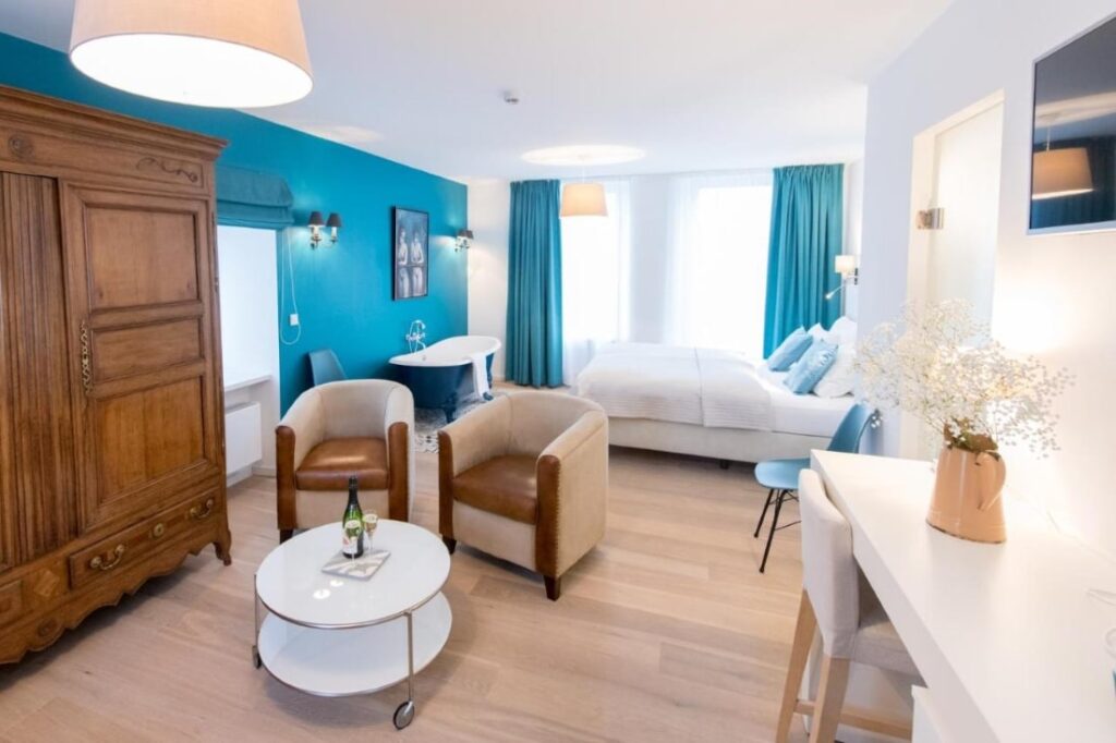
This B&B offers 7 comfortable and quiet rooms in the center of Berdorf. All rooms have their own theme. Berdorfer Eck is the perfect starting point for the different hikes in the Mullerthal region. The B&B also has a little shop where you can buy regional products.
Trail-inn Natur & Sporthotel – Berdorf
Check prices and availability: BOOKING.COM
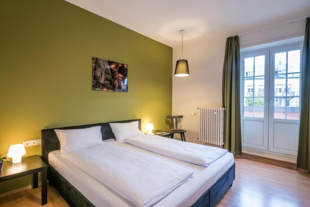
This hotel in the center of Berdorf offer standard rooms and family rooms. The hotel has a restaurant and a nice terrace, making it an excellent place to drink a beer during warm summer days. As this hotel is situated in the center of Berdorf, it’s close to the different hikes in the area.
Youth Hostel Echternach – Echternach
Check prices and availability: BOOKING.COM
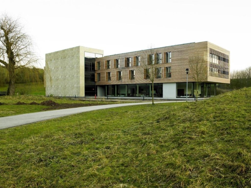
The youth hostel of Echernach is set in a futuristic building close to Lake Echternach. It offers shared dormitories with bunk beds and cabinets for your luggage. There is free Wi-Fi and a fully equipped sports center. Breakfast is available in the morning. In the evening, you can have a drink or snack in the cafetaria. The hostel is situated less than 2 kilometers from the center of Echternach.
B&B Roudenhaff – Echternach
Check prices and availability: BOOKING.COM
This bed and breakfast is located at Lake Echternach, at about 3,5 kilometer from the city center. There is a wellness and fitnesscenter and free WiFi. The rooms and appartments all have an own bath room with shower. The appartments have a living room and kitchen. In the morning, they offer breakfast and they can offer a packed lunch on request. If you want to relax after a day of hiking, you can use the sauna, solarium or the hot tub.
More information about the Mullerthal trail
Unless you are trail running, hiking the entire trail (around 37-38 kilometers) is (almost) impossible to do in just one day (at least for us it is). Therefore, we suggest you to start in one direction and then take a bus back to your starting point. The next day, you can start hiking in the opposite direction. When we visited this region (July 2018), busses were for free. We’re not sure if this was because of the summer months. However, normal prices are around 2 euros per person and children are free of charge. To see all the bus stops in the region, we suggest you to download the maps.me app. Via this app you can see all the bus stops close by. The app also offers offline navigation info that can come in handy when hiking.
The trails are well-indicated by the letter M signs and different information panels along the way.
To decide which trail to do, we added more information about the specifics each trail has to offer. Small villages are dotted around each trail, so you can decide for yourself where to start the hike. However, in the descriptions below we describe our ideal starting and return point for each trail.
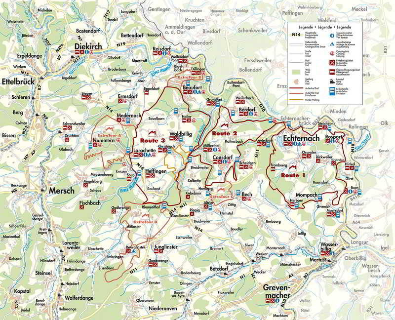
Trail 1
According to us Echternach is the ideal starting point for this trail. The trail takes you along some cultural views but also the typical landscape elements of this region: forest, rocks and meadows. The length of the trail is 38 kilometers and it is considered as a medium hike. You can take the bus back from Mompach or Herborn and start in the other direction the next day.
Trail 2
Again, Echternach is a good starting point for this trail. This trails takes you through amazing forests and wild rock formations. The trail is 37 kilometers, but compared to the other two, the most difficult one, with different sections of uphill hiking. When coming from Echternach, Haenricht or Hersberg are ideal places to take the bus back. We started this hike from Berdorf and took the bus back in Consdorf. The other day, we hiked the opposite direction.
Trail 3
The ideal starting point for this route is Beaufort. This will give you the opportunity to visit the old fort in this village. Trail 3 is the most romantic route, taking you through meandering valleys and old ruins. The entire trail takes 37 kilometers and requires medium effort. When starting in Beaufort, you can take the bus back in Blumenthal.
What to take with you when hiking the Mullerthal trail?
We always recommend you to hike responsible. That involves being prepared for any sort of weather condition or problem you might face along the way. When hiking, always …
- … wear appropriate footwear. Even when temperatures are hot, slippers are not suitable for hiking! At least wear trail shoes or even better, invest in decent hiking boots. There are some steep parts, so trekking poles come in handy, both for going up as going down.
- … carry plenty of water with you. Even though you pass several villages during your hike, it still is sensible to have at least 1.5 liter of water per person with you. When we hike, we are always very happy to have a CamelBak with us.
- … take food and snacks with you. Enough food keeps up the energy and morale. And what’s better than enjoying a piece of good cheese and bread with a magnificent view?
- … have something with you to help you navigate. Maps and GPS are excellent tools for that. We like to use maps.me, an app for offline navigation. But when using an app, make sure your mobile phone is charged and consider taking a powerbank with you.
- … take rain gear and other clothes with you. Needless to explain this one, I suppose?
- … carry some sort of knife with you. Best case, you only use this to open the piece of cheese you have with you. Worst case scenario, this can help you in problem situations to cut bandages, remove splinters, …
- … have a first aid-kit with you. Splinters, blisters, … are not exactly things you don’t want to treat during hiking.
- … take a flashlight with you! We already had to hike when it was dark. Definitely not a fun experience. Since then, we always carry a flashlight with us.
- … bring your camera. Capture your memories!
- … bring a waste bag and leave not trave. A reusable ziplock bag is excellent for keeping the trash separate from the rest of your gear.
If you have any questions about the Mullerthal trail, do not hesitate to contact us or leave a comment below. We love hearing from you!
Thanks for reading and … Happy hiking!
Matthias and Mieke